Designing a Long-Range Scout Drone for Wildfire Intelligence
Inside the R&D journey of building a fixed-wing surveillance drone designed for continuous wildfire intelligence at scale.
From Concept to Operational Platform
When we started developing VATROGON’s long-range scout drone capability, we didn’t begin with hardware.
We began with a question:
How do you monitor thousands of square kilometers continuously, without aviation infrastructure, and without burning operational budgets?
The answer required rethinking traditional drone architecture.
The Challenge: Persistent Surveillance at Scale
Wildfire environments demand:
Long endurance (6+ hours)
Stable flight in thermal turbulence and wind guts
Redundant navigation
High-efficiency propulsion
Modular sensor payloads
Field repairability
Most commercial multirotors simply cannot achieve this combination. So we focused on fixed-wing long-endurance architecture, inspired by platforms such as the Flightory MOOSE class — but optimized for wildfire intelligence missions.
We designed and iterated 3D-printed structural components to:
Reduce airframe weight
Allow rapid prototyping
Enable field-replacement parts
Customize payload bays
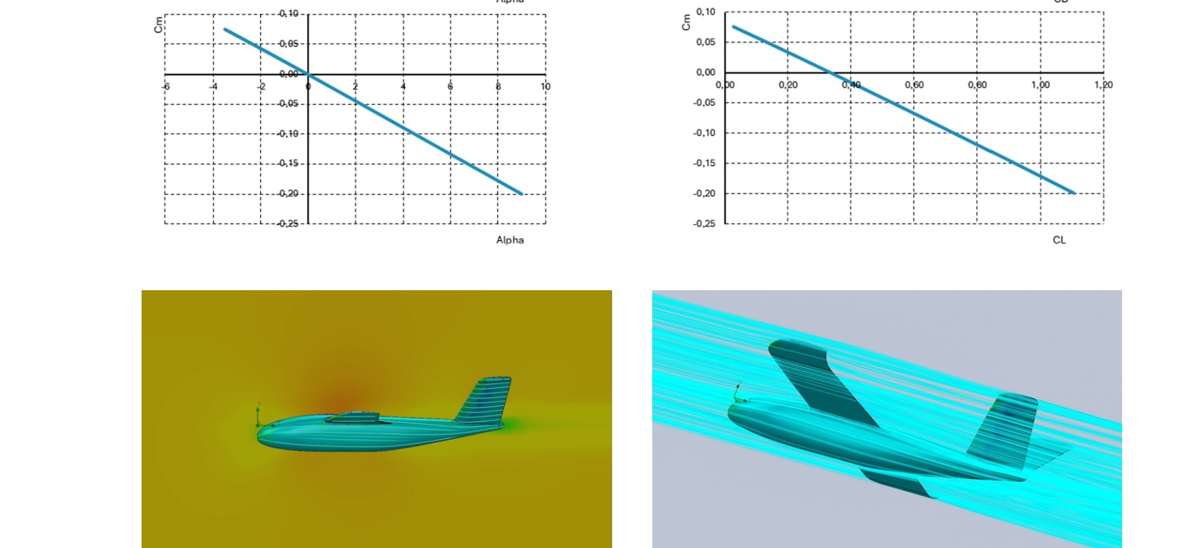
Using reinforced polymer composites, we tested multiple fuselage geometries to optimize:
Lift-to-drag ratio
Crosswind stability
Thermal updraft tolerance
The result: A lightweight, high-aspect-ratio wing configuration capable of extended loiter time over high-risk zones.
2️⃣ Powertrain Optimization
Endurance is energy management.
We tested:
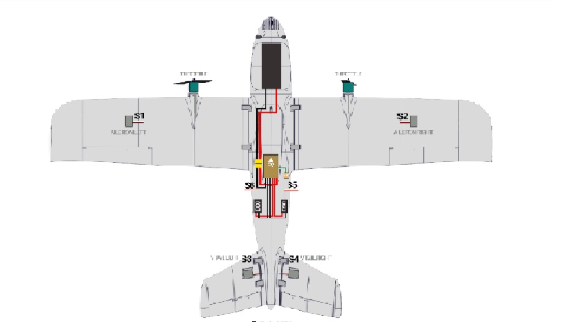
High-efficiency brushless motors
Folding propeller systems
Optimized ESC calibration
Lithium-ion endurance battery packs
Hybrid fuel-assisted concepts (future roadmap)
Through iterative propulsion tuning, we achieved:
Reduced cruise power draw
Optimized climb profile
Stable low-speed loiter performance
3️⃣ Sensor & Mission Architecture
A long-range scout drone is not just an aircraft — it’s a flying data node.
The VATROGON scout platform integrates:
EO (electro-optical) camera
Thermal imaging sensor
Real-time video transmission
AI-assisted fire detection algorithms
Georeferenced mapping output
We designed the avionics architecture to support:
Beyond Visual Line of Sight (BVLOS)
Encrypted telemetry
Autonomous return-to-base
Redundant GNSS positioning
"I've been on several tours with Outdoor, and each one has left me feeling rejuvenated and inspired. The attention to detail and the seamless organization make them my go-to choice for outdoor adventures."
Samantha Carsin
lovely Tourist
Why It Matters for Customers
This R&D effort enables:
- Early ignition detection - Continuous territory mapping - Real-time decision support - Reduced dependency on manned aviation - Lower long-term operational cost per km²
In wildfire protection, minutes matter.
A long-endurance scout drone shifts firefighting from reactive to predictive.
What’s Next?
We are currently working on:
Solar-assisted endurance enhancement
AI-based smoke pattern recognition
Autonomous swarm coordination
Weather-adaptive flight algorithms
Because wildfire protection isn’t about flying drones.
It’s about building intelligent aerial infrastructure.